
Ramfjellet rundt - a 13hr adventure
Into the Heart of Skarvan & Roltdalen: A 13‑Hour Detour Through Reindeer Country
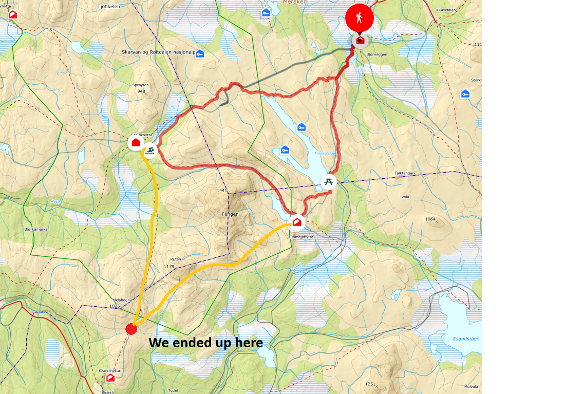
There are days when the mountains hand you exactly what you came for — and others when they hand you something entirely different. Our planned 53‑kilometer triangle through Skarvan og Roltdalen nasjonalpark was supposed to be one of the smooth ones: Bjørneggen → Schulzhytta → Ramsjøhytta → back to Bjørneggen. A classic and well‑trod round in one of Norway’s most pristine national parks, known for its old‑growth forest, rolling highlands, and the massive reindeer herds that have shaped this landscape for centuries.
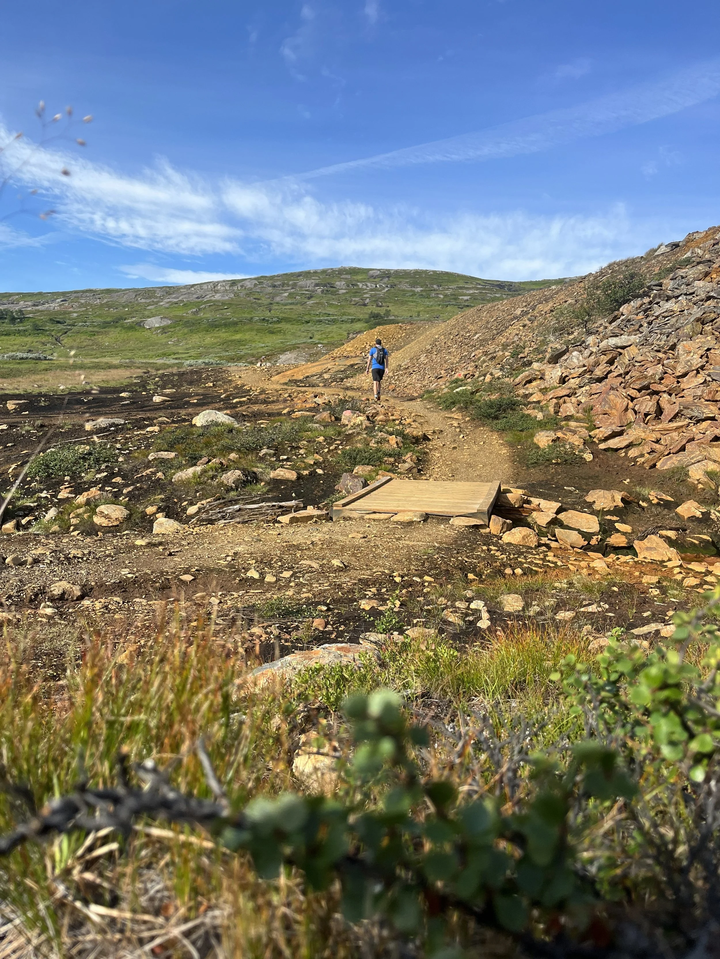
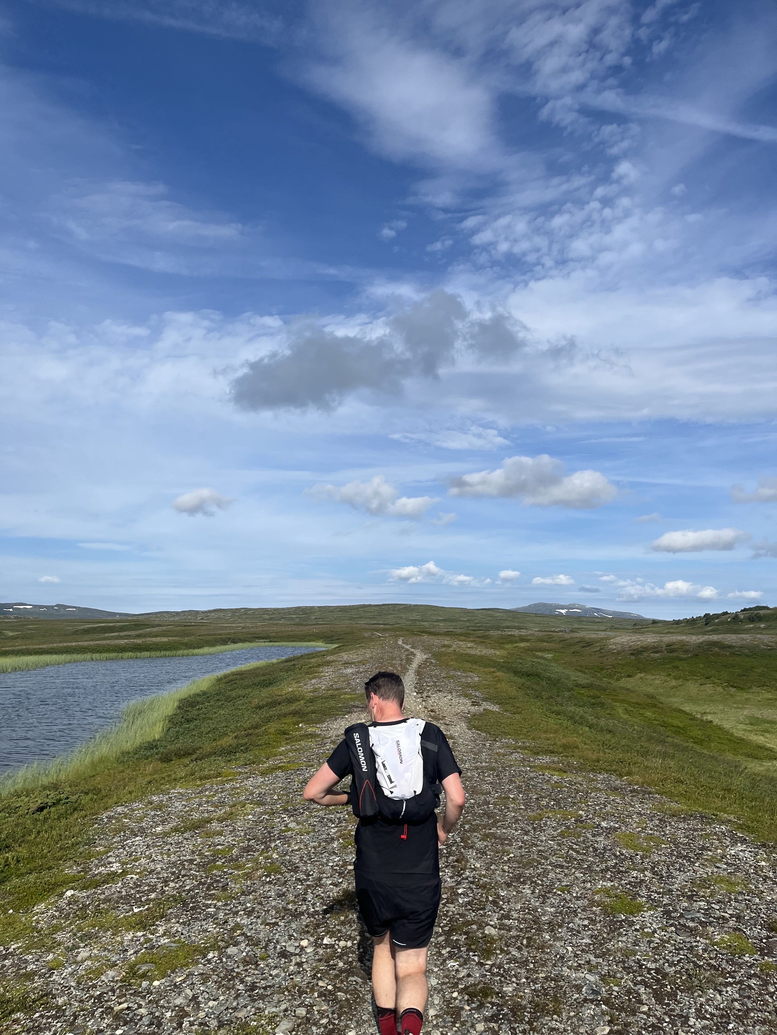
The first hours felt exactly like the outing we’d imagined. From Bjørneggen, the trail climbs gently into the park’s open terrain, following one of many well-marked routes maintained by the Trondhjems Turistforening and DNT Nord-Trøndelag. These path systems stitch together a network of historic cabins — including Schulzhytta, Prestøyhytta, and Ramsjøhytta — and make this region one of the most accessible hut‑to‑hut areas in Trøndelag.
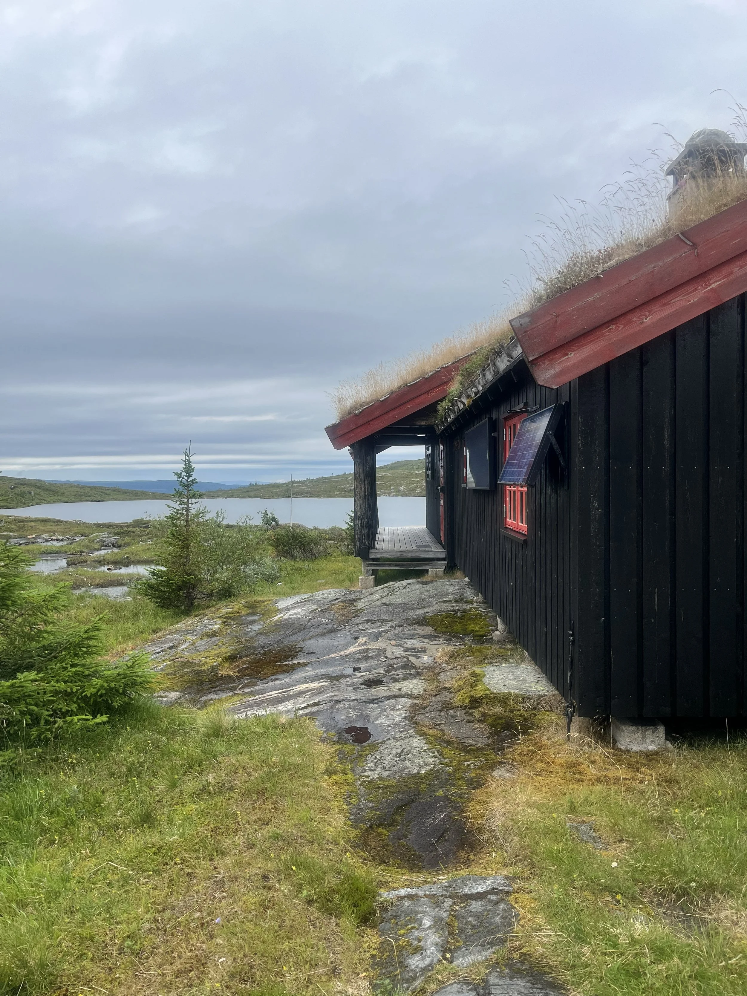
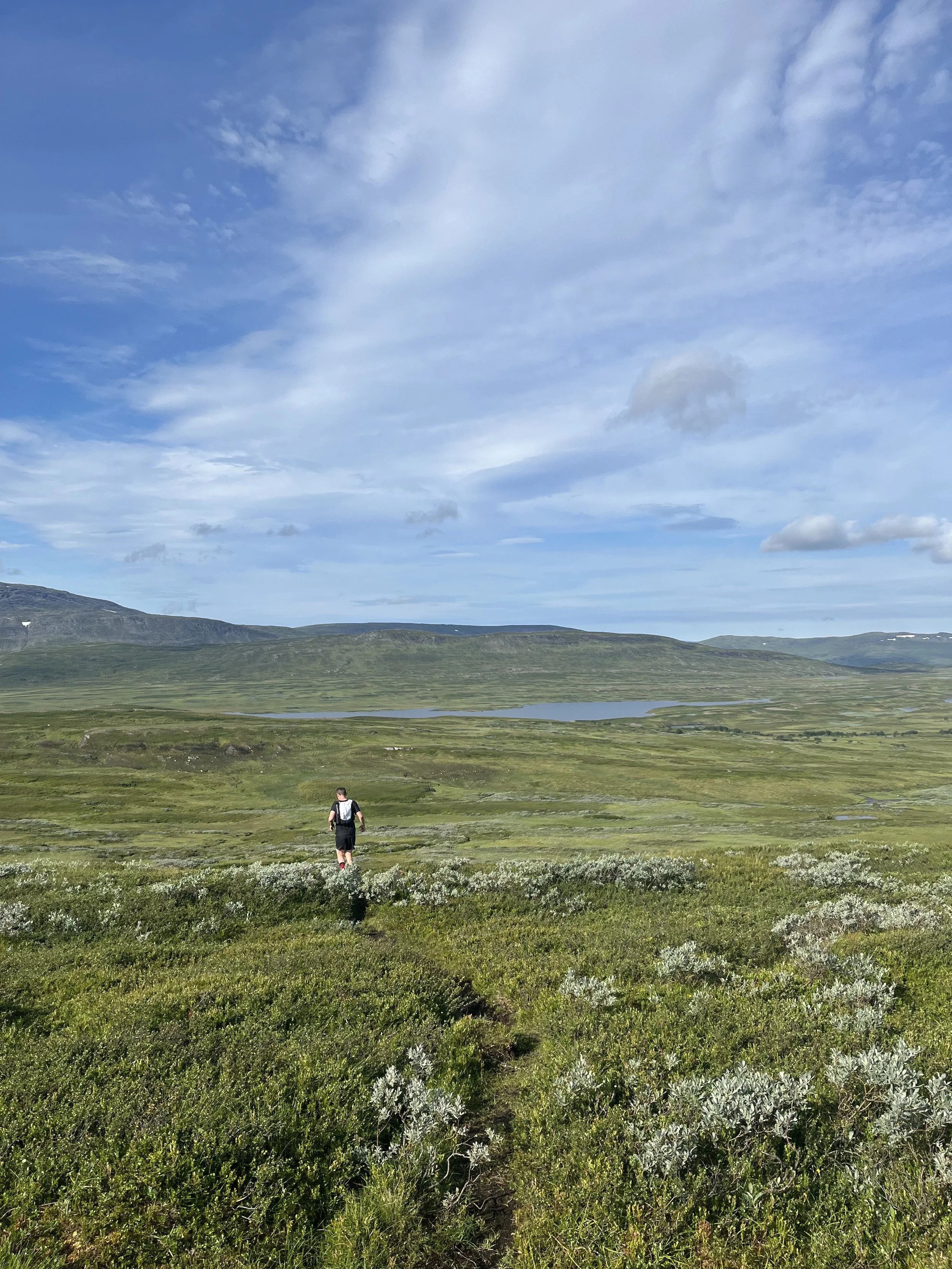
The stretch from Bjørneggen to Schulzhytta is runnable, playful, and scenic. Rivers and wetlands catch the morning light; rolling hills open into broad, Norway‑across vistas; and the kilometers flow easily. Schulzhytta itself sits like a red‑roofed anchor in the center of the national park, long established as a key waypoint on the “Norge på tvers” route. It’s the kind of place where you expect to top up water, grab a bite, and be on your way.
But that was where our tidy plan ended.


The Misturn
A few minutes after leaving Schulzhytta, we made the kind of navigational error that feels tiny in the moment — a simple comfort‑driven decision about which path “looked right.” Instead of angling southeast toward Ramsjøhytta, we drifted into the opposite quadrant entirely.
And Skarvan & Roltdalen has a way of letting you know when you’re no longer where you should be.
The terrain changed first. Instead of steady paths across open highlands, we found ourselves in increasingly broken country. Marshy depressions, tilted slabs, long tracts of boulder fields, and brushy valleys that swallowed the rhythm of running. After a while, we realized that nothing around us matched the map and that the next landmark wasn’t going to be Ramsjøhytta but Tjønnstuggo, far to the east — and very much not on our agenda.
From here, we had a choice, though not a comfortable one: 37 kilometers back to the car, no matter which direction we pointed ourselves. Either retrace everything, or cut straight across the mountains to reconnect with the route between Ramsjøhytta and Bjørneggen. We chose the mountains.
Across the Rugged Spine
The detour became a different journey entirely. We left the comfort of marked DNT trails and moved into raw, trackless terrain where ridges fall off abruptly and small valleys twist away from each other like puzzle cuts. It was slow, deliberate travel — the kind that makes you feel both tiny and entirely awake.
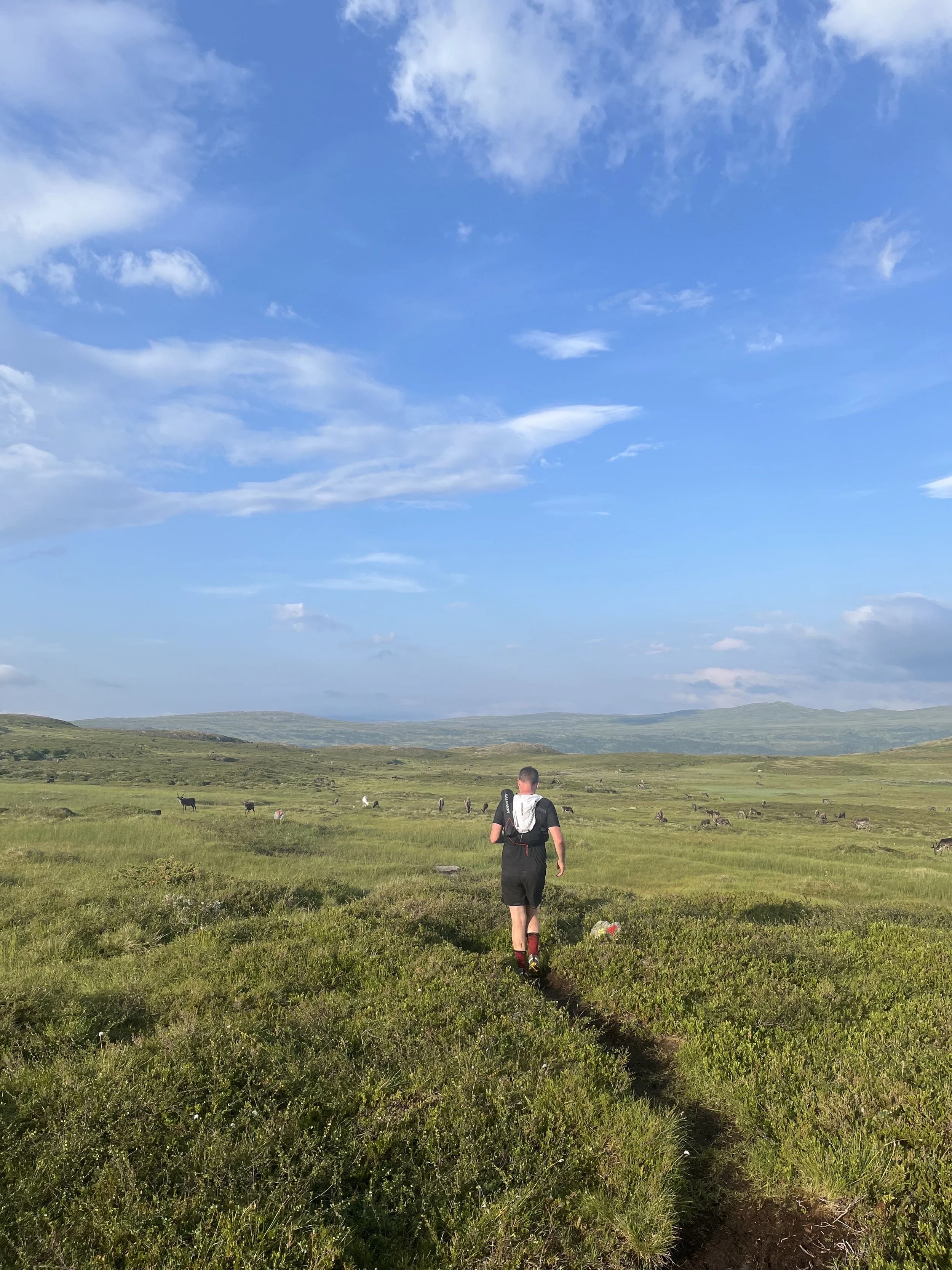
But the landscape rewarded us. As we climbed onto the higher shoulders between valleys, we found ourselves in the middle of thousands of reindeer, moving like a living tide across the slopes. Skarvan og Roltdalen is an important reindeer herding landscape, part of a cultural system stretching back generations, and seeing the herd up close is as humbling as any summit view. The presence of locals gathering and guiding groups of reindeer toward evening pastures made the moment even more surreal — a reminder that this is not just wilderness, but working land shaped by Sámi tradition and seasonal rhythms.
Hours passed like this: climb, contour, drop, climb again. Wet feet became the tax we paid for each valley crossing. Energy ebbed and returned in cycles. But eventually, after enough stubborn kilometers, the shape of the terrain shifted once more — this time in our favor — and the trail network reappeared.
Finding the Line Again
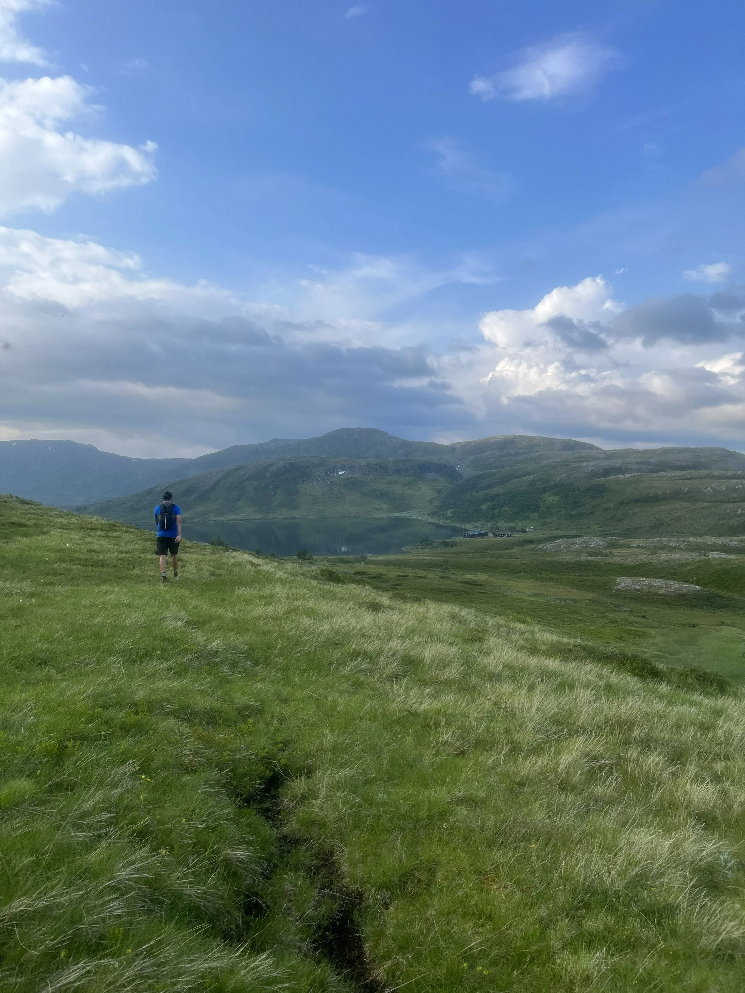
Reaching the trail near Ramsjøhytta felt like slipping back into a familiar language. The ground firmed up, the markings reappeared, and our brains could finally stop navigating and simply move. The hut itself is a cornerstone on the “Norway Across” route, sitting at the mouth of Lake Ramsjøen with a view toward Fongen and the high peaks framing the park’s southern spine.
The last stretch back to Bjørneggen was pure relief: runnable paths, open terrain, and the promise of the car somewhere beyond the forests below. After more than 13 hours on our feet, we reached the end — soaked, tired, satisfied.
Five minutes later, the sky cracked open and a lightning storm rolled directly over us. One of those perfect endings you couldn’t script if you tried.
A Wild Loop That Wasn’t a Loop
We didn’t complete the intended triangle. We didn’t see the Schulzhytta → Ramsjøhytta trail that UT.no describes as one of the most scenic hut‑to‑hut connections in the Trøndelag mountains. But the national park handed us something better: an unplanned traverse across untouched ridges, a close encounter with a migrating reindeer herd, and a reminder that even the “easy” parts of Norway’s mountains deserve respect.
Skarvan og Roltdalen is a place of old forests, high wetlands, ancient Sámi grazing lands, and quiet, powerful landscapes. Whether you stick to the route or lose it completely, the mountains have a way of giving you exactly the story you didn’t know you came for.
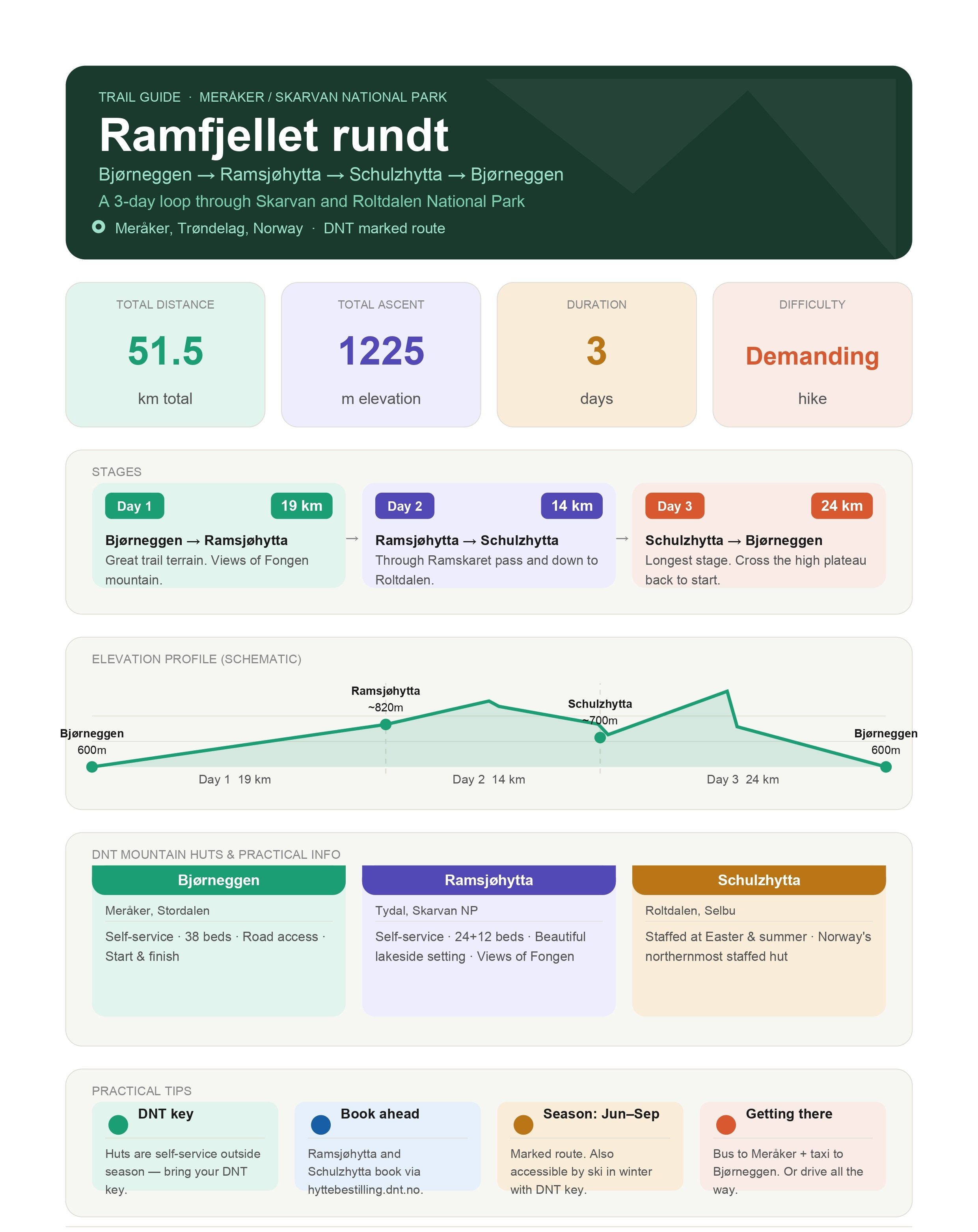
Underneath is the info for the actual tour (make sure you don`t do the same mistake as us) divided into a three day trip as it`s suggested and not the one day effort we did. We also reversed the round-trip and ran Bjørneggen - Schulzhytta - Ramsjøhytta.
When is the best time to do Ramfjellet rundt?
The route is best from late June to mid-September, when the marked trails are fully snow-free and all
huts are accessible. July and August offer the most stable weather. Spring skiing is also possible with a
DNT key, but the route is unmarked in winter.
Do I need to book the huts in advance?
Yes — especially for Schulzhytta and Ramsjøhytta in peak season (July–August). Book via
hyttebestilling.dnt.no. Bjørneggen also has online booking. Drop-in is possible outside peak periods, but
capacity is limited — Ramsjøhytta's new main cabin has 22 beds, plus 12 in the annex.
Do I need a DNT membership and key?
A DNT key is required to access the self-service huts outside staffed periods. DNT members get around
30% off hut prices. Non-members can still stay but pay full price. Membership also gives access to 560+
huts across Norway. Drop-in payment is via the 'DNT Hyttebetaling' app.
How physically demanding is the route?
It is classified as a demanding hike. You should be comfortable carrying a 10–12 kg pack over 3 days,
and have experience on uneven mountain terrain. Day 3 is the longest (24 km) and most physically
taxing. No technical climbing is required — it follows marked DNT trails throughout. For experienced trail
runners this trip contains limited of elevation gain, so it`s a pretty good route for a day trip.
What gear and footwear do I need?
Sturdy mountain boots with ankle support (already broken in) are required, or good trail shoes.
We ran the loop in our old Nike Pegasus Trail. Bring full rain gear, warm
layers, a headlamp, and a first aid kit. A DNT key is essential. DNT recommends using a lakenpose
(sleeping bag liner) or full sheet set — sleeping bags are not permitted inside the huts for hygiene
reasons.
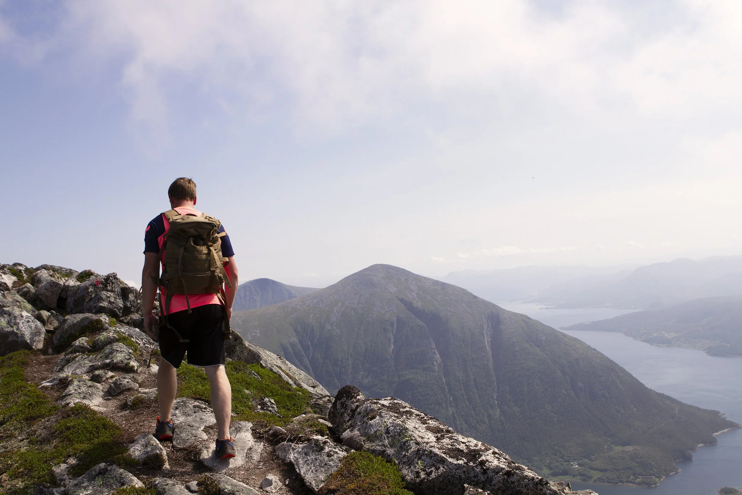
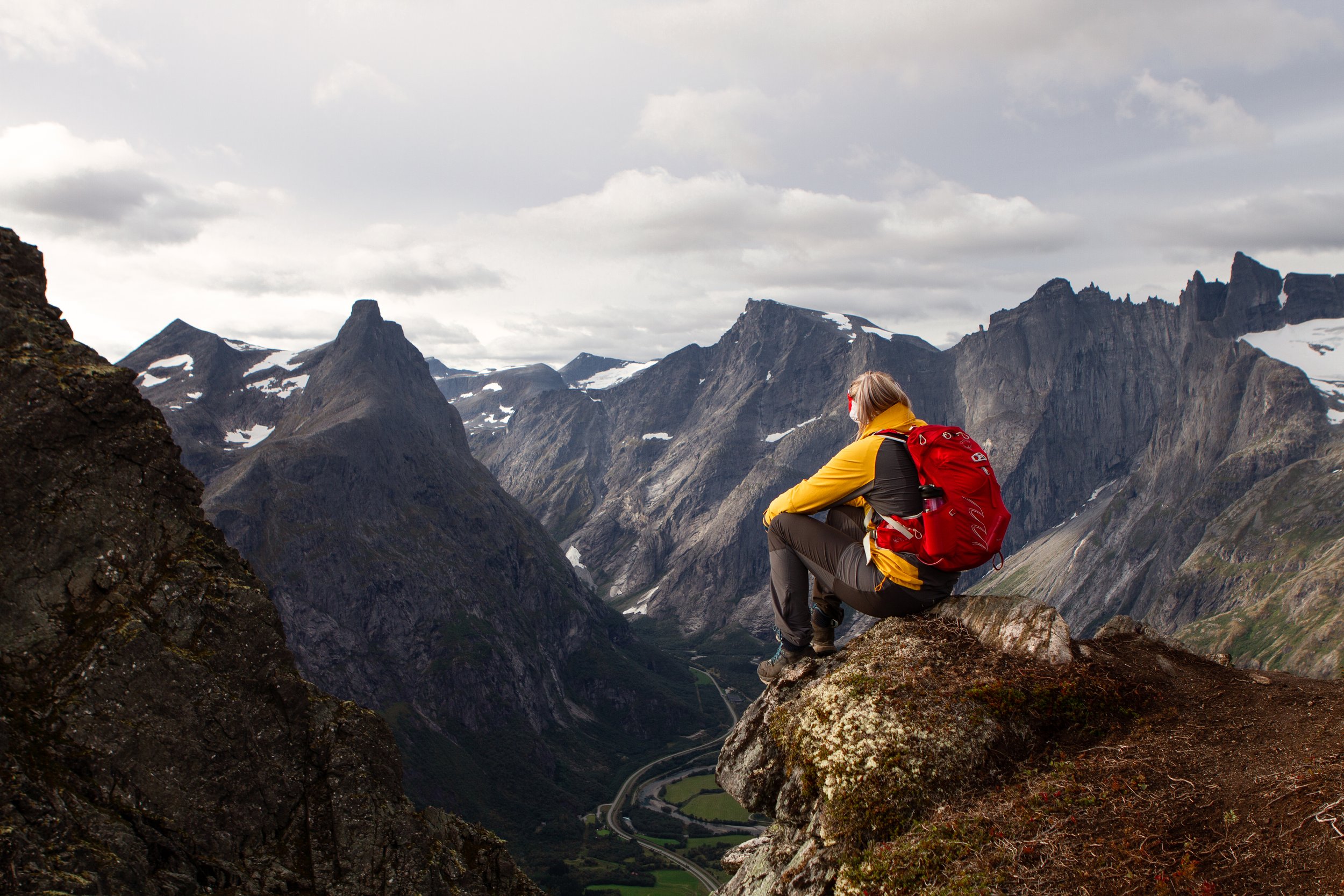
One of Norway’s most scenic trails above Hardangerfjord.
Steep ridges, open plateaus and views that stretch far beyond the map.